Understanding Meramec River Levels: How to Plan the Perfect Float Trip
One question we hear all season long at Blue Springs Ranch is a good one: “How is the river running right now?” It is smart to ask. The Meramec River is a living, moving thing, and the water level on any given weekend shapes how your float feels. A little bit of know-how goes a long way toward a safe, fun, no-surprises day on the water.
The good news is that the upper Meramec near Bourbon, Missouri is a calm, beginner-friendly stretch. It is classified as a Level 1 river, which means gentle current and no serious rapids. Still, knowing how to check the water before you load the cooler makes every trip better. Here is our plain-English guide to Meramec River levels and how to use them to plan the perfect float.
Why river levels matter for your float
Water level affects three things you actually care about: how fast you move, how deep the water is, and how much paddling you do.
When the river is running at a comfortable summer level, the current carries you along at an easy pace. You drift, you splash, you park on a gravel bar for lunch, and the miles pass without much effort. This is the sweet spot, and it is where the Meramec sits most of the float season.
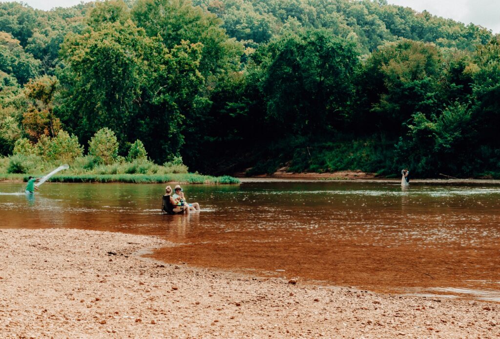
When the river is low, usually in late summer, you move slower and you may bump or scrape over shallow gravel bars in a few spots. It is still a great day, you just do a little more paddling and maybe a short walk to guide your canoe over a shallow riffle.
When the river is high, often after heavy rain, the current speeds up and the water gets murkier. A faster river is not automatically a dangerous one, but it changes the trip. We keep a close eye on conditions, and if the water climbs too high we will pause float trips for safety. That is exactly why we would rather you call and ask than guess.
How to read Meramec River levels before you go
You do not need to be a hydrologist. You just need to know where to look and roughly what the numbers mean.
Check the USGS river gauge. The U.S. Geological Survey posts live Meramec River readings online, measured in feet (gauge height) and cubic feet per second (streamflow). Anglers and floaters watch these gauges every day during the season. You can find current Meramec River data on the USGS Water Data site. Look for gauges near Steelville and Sullivan, which are closest to our stretch of the upper river.
Compare against normal. A single number does not tell you much on its own. What matters is how it compares to the typical range for that time of year. USGS gauge pages show the median for the date, so you can see at a glance whether the river is low, normal, or running high.
Watch the rain. The Meramec responds to rain in its watershed, sometimes a day or two after a storm. A dry, sunny week usually means steady, floatable levels. A stretch of heavy Ozarks thunderstorms can push the river up fast, then it settles back down over the following days. The Missouri Department of Conservation is another solid resource for river and water information across the state.
Call us. Honestly, this is the easiest step. Our team is on the water and on the property every day the river is open. We know exactly how it is running, whether the gravel bars are exposed, and what watercraft we recommend that day. Give us a ring at (800) 333-8007 and we will give you the straight story.
What “normal” looks like on the upper Meramec
Float season at Blue Springs Ranch runs from April 15 through October 31, and the river behaves a little differently across those months.
Spring (April to May): Fed by spring rains, the river often runs a touch higher and cooler. Great current, fast floats, and green, lively scenery along the banks. Bring a light layer for cooler mornings.
Early to mid summer (June to July): This is prime time. Levels usually settle into that comfortable, carry-you-along range, the water warms up, and the gravel bars are perfect for swimming and lunch stops. It is the classic Ozarks float.
Late summer (August to early September): The river tends to drop as rain slows down. Floats get lazier and shallower. You may do a little more paddling, but the water is warm and the crowds thin out. Many regulars love a low, mellow late-summer float.
Early fall (late September to October): Cooler air, gorgeous color in the Ozark hills, and quieter water. Levels depend on fall rain, so this is a great time to check conditions before you come.
No matter the month, our floating page has the details on our 5-mile and 10-mile trips, and our team can match the right level of adventure to that day’s water.
Matching your watercraft to the water
River level even plays into which boat is the best pick.
When the water is at a good level, anything goes: canoes, single kayaks, rafts, and lazy innertubes all float beautifully. When the river runs a bit lower, canoes and kayaks handle shallow spots more easily than a big raft, and tubes are still a blast if you do not mind an occasional scoot across a gravel bar. Our staff will steer you toward the right choice when you check in. You can see the full lineup of canoes, kayaks, tubes, and rafts on our floating page.
Safety comes first, always
A Level 1 river is about as beginner-friendly as it gets, and thousands of families float it every summer. That said, a few simple habits keep everyone happy:
- Wear your life jacket. We provide them, and kids especially should keep them on.
- Never float during or right after a big storm without checking with us first.
- Watch your kids near the water, even in calm current.
- Skip the glass and pack out what you pack in to keep the Meramec beautiful.
If conditions ever climb into unsafe territory, we will let you know and help you reschedule. Your safety and a good time are the whole point. You can review our float guidelines any time on our FAQs page.
Frequently asked questions
What is a good Meramec River level for floating? A comfortable summer level gives you steady current without shallow scraping or fast, murky water. Since the ideal number shifts with the season, the best move is to check the USGS gauge near Steelville or Sullivan, compare it to the median for that date, or simply call us at (800) 333-8007 for a same-day read.
How do I check the Meramec River level near Blue Springs Ranch? Look up the USGS river gauges closest to our upper-river stretch, near Steelville and Sullivan, on the USGS Water Data website. Or call our team, since we monitor conditions on the water every day the river is open.
Does rain cancel float trips? A little rain does not stop the fun. Heavy or prolonged storms can raise the river to unsafe levels, and in that case we may pause float trips for safety. We always recommend calling ahead if big weather rolls through.
Is the Meramec River safe for beginners and kids? Yes. Our stretch is a Level 1 river, meaning gentle current and no serious rapids, which makes it ideal for first-time floaters and families. Life jackets and basic supervision keep everyone safe.
When is the best time of year to float the Meramec? June and July usually offer the most reliable, comfortable levels and warm water. Spring floats are faster and cooler, while late summer is lazy and shallow. Fall depends on recent rain, so check conditions before you come.
Plan your float with confidence
Reading the river is half the fun of planning an Ozarks adventure. Check the gauges, watch the weather, and when in doubt, call the folks who live on this river. We would love to help you pick the perfect day.
Ready to hit the water? Book your float trip online or call us at (800) 333-8007. The Meramec is waiting.